Mostrando entradas con la etiqueta Spain's relief. Mostrar todas las entradas

lunes, 14 de diciembre de 2020

MOUNTAINS AND RIVERS OUTSIDE THE MESETA

MOUNTAINS OUTSIDE THE MESETA

What mountain systems are there in northern Spain?


There are four mountain systems in the north of the Iberian Peninsula that do not form part of the Meseta.

• The Galician Massif is in the northwest of the peninsula.

• The Basque Mountains are between the Catalan Coastal Range and the Pyrenees.

• The Pyrenees form a natural border between Spain and France. Aneto is the highest peak of the Pyrenees in Spain.

• The Catalan Coastal Range is in the northeast. The mountains are less than 2 000 metres high.


What mountain systems are there in southern Spain?

Mulhacén

The main mountain system is called the Baetic System. There are two main mountain ranges:

• The Penibaetic Range is very close to the Mediterranean coast. Mulhacén is the highest peak on the Iberian Peninsula.

• The Subbaetic Range is further from the coast. It is not as high.


RIVERS OUTSIDE THE MESETA

What are the main river valleys outside the Meseta?


The Ebro River Valley is a fertile area in the northeast of the peninsula. The land where the Ebro flows into the Mediterranean Sea is low, flat and shaped like a triangle. It is called a delta .

The Guadalquivir River Valley is a fertile area in the southeast of the Peninsula. The Guadalquivir flows into the Atlantic Ocean, forming marshlands.


CANCIÓN DE LAS MONTAÑAS Y LOS MARES


OUTLINE

VOCABULARY

MAPA PARA ESTUDIAR (HAZLO LAS VECES QUE SEAN NECESARIAS)


TIME TO PLAY!


viernes, 11 de diciembre de 2020

THE MESETA


The Meseta is the largest plateau in Spain. It is in the centre of the Iberian Peninsula, and can be found in Castilla y León, Madrid, Castilla-La Mancha and Extremadura. The elevation is high, with a range of 610 metres to 760 metres. There are two mountain systems on the Meseta:


• The Central System divides de Meseta into two parts: the Northern sub-plateau and the Southern sub-plateau. Its mountain ranges include Somosierra, Guadarrama and Gredos.

Central System


• The mountain system called the Toledo Mountains is in Submeseta sur. It separates the Tajo River Valley and the Guadiana River Valley.

Toledo Mountains


What mountains surround the Meseta?

The Meseta has four mountain systems that surround it.


The Mountains of León are in the northwest, between Castilla y León and Galicia.


The Cantabrian Range is in the north. It is a natural border between Castilla y León to the south and Cantabria and Asturias to the north. Picos de Europa is here.

The Iberian System is to the east. It separates the Meseta and the Ebro River Valley.

The Sierra Morena is in the south. It runs between the river valleys of the Guadiana and the Guadalquivir.


SISTEMAS MONTAÑOSOS DE ESPAÑA

VOCABULARY


¡TIME TO PLAY!

miércoles, 9 de diciembre de 2020

Drainage basins

DRAINAGE BASINS 

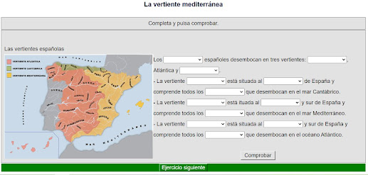
A drainage basin is an area of land that drains all its water into the same sea, ocean or lake. Spain has three main drainage basins.

The Cantabrian Basin: 5% of all the water. The sources of most rivers in this basin are in the Cantabrian Range. The rivers are short and have the most stable regimes of all Spanish rivers.

The Atlantic Basin: 65% of all the water. Most rivers here flow through the Meseta and the Guadalquivir Depression. They have variable regimes. The Iberian Peninsula slopes to the west, so most of the water on the peninsula drains into the Atlantic Basin.

The Mediterranean Basin: 30% of all the water. All the rivers here, except for the Ebro, are short. They have variable regimes and, in some cases, they are dry in summer. There are no permanent rivers in the Balearic or Canary Islands or Ceuta and Melilla.


The Atlantic Basin

The rivers of the Atlantic Basin flow into the Atlantic Ocean. These rivers are divided into two groups.

Rivers in Galicia are short with a high discharge and stable regimes. The main ones are the Eume, the Tambre, the Ulla and the Miño, with its tributary, the Sil. The Miño creates a physical border with Portugal.

Miño 


Rivers in the Meseta and the Guadalquivir Depression
are long with a high discharge and variable regimes. They begin in mountains inland, and cross areas that have rain in autumn and spring.

Tajo

Guadalquivir

Guadiana

Duero


The Mediterranean Basin

The rivers of the Mediterranean Basin flow into the Mediterranean Sea. The rivers in the east vary in length. They have a low discharge and extremely variable regimes. The exceptions are the rivers Ter and Ebro.

The rivers in the south, like the Guadiaro, are short because they start in the Penibaetic Range near the coast. They have a low discharge and variable regimes.

The main reservoirs in the Mediterranean Basin are Mequinenza (Zaragoza), Alarcón and Contreras (Cuenca), and Almanzora (Almería).

Llobregat

Ebro

Turia

Júcar

Segura


The Cantabrian Basin

Rivers in the Cantabrian Basin flow into the Cantabrian Sea. They flow though Asturias, Cantabria and the Basque Country. These regions have heavy rainfall all year. The rivers have a high discharge and stable regimes.

They are short because their sources are close to the sea. The Cantabrian Basin is a good location for reservoirs  because there are many steep valleys.

Eo

Navia

Bidasoa


OUTLINE


TIME TO PLAY!