What are depressions?
Depressions are large, flat areas of land that are lower than the surrounding area. In Spain, there are two main depressions, the Ebro Depression and the Guadalquivir Depression. Both contain long rivers which flow to the coast. SPANISH: Las depresiones son grandes y llanas zonas de tierra que son más bajar que la zona por la que está rodeada. En España hay dos depresiones, la Depresión del Ebro y la Depresión del Guadalquivir. Ambas contienen largos ríos que desembocan en la costa.

What is the Ebro Depression like?
The Ebro Depression is located between the Pyrenees and the Iberian System. It occupies land in four autonomous communities. The average altitude is 200 metres. At the mouth of the Ebro there is an area of low wetlands called the Ebro Delta. The land is very fertile in this area. It receives deposits of materials collected along the course of the river, from its source in Cantabria to the Mediterranean coast. It forms part of the Ebro Delta National Park. SPANISH: La Depresión del Ebro se encuentra localizada entre los Pirineos y el Sistema Ibérico. Ocupa cuatro comunidades autónomas. Su altitud media es de 200 metros. En la desembocadura del Río Ebro hay una zona de humedales bajos llamada Delta del Ebro. La tierra es muy fértil en esta zona. Recibe depósitos de materiales recogidos a lo largo del curso del río, desde su nacimiento en Cantabria hasta la costa mediterránea. Forma parte del Parque Nacional del Delta del Ebro.

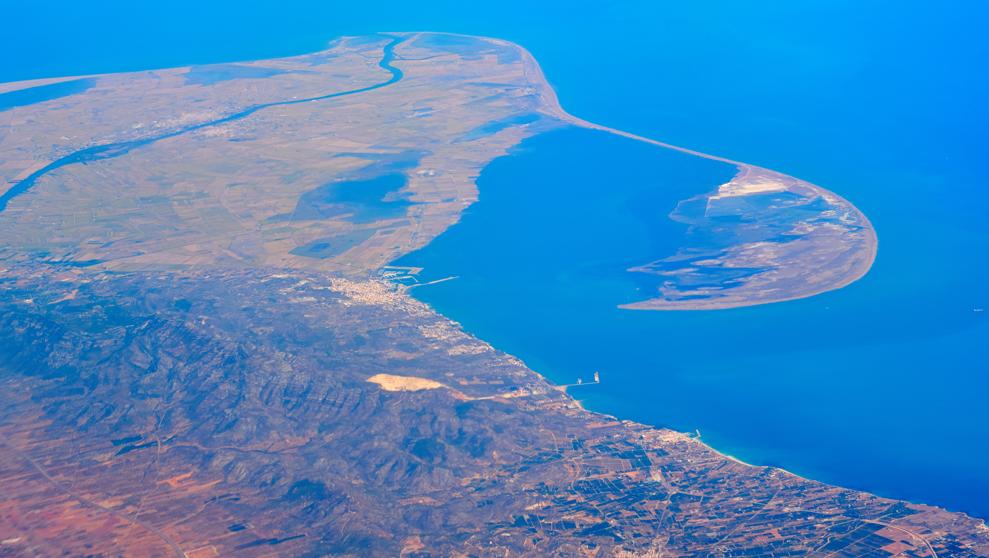 |
| Ebro Delta |
What is the Guadalquivir Depression like?
The Guadalquivir Depression runs from east to west through Andalucía, between the Sierra Morena and the Subbaetic Range. The average altitude of land in the Guadalquivir Depression is 100 metres and it is the lowest on the peninsula. The source of the Guadalquivir River is in the Cazorla Mountains. The Guadalquivir Depression widens as the river reaches the ocean. In the lowlying coastal area around the mouth of the river, the tide floods the lands. The salt marshes that are formed by sea water are extremely fertile and are part of Doñana National Park. SPANISH: La Depresión del Guadalquivir reocorre de este a oeste por Andalucía, entre Sierra Morena y la Cordillera Subbética. La altitud media del terreno es de 100 metros y es la más baja de la península. El nacimiento del río Guadalquivir está en la Sierra de Cazorla. La depresión del Guadalquivir se ensancha a medida que el río llega al océano. En la zona costera baja alrededor de la desembocadura del río, la marea inunda las tierras. Las marismas que forman el agua del mar son sumamente fértiles y forman parte del Parque Nacional de Doñana
 |
| Guadalquivir Depression |
 |
| Guadalquivir Depression |
 |
| Cazorla |
No hay comentarios:
Publicar un comentario
Nota: solo los miembros de este blog pueden publicar comentarios.